Breece Robertson Photo by Eric Laycock
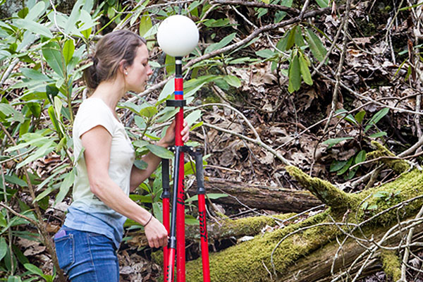
BOONE, N.C. — Alumna Breece Robertson earned her master’s degree in geography and planning from Appalachian State University in 2000. She joined The Trust for Public Land in 2001 to create a coordinated geographic information systems (GIS) program, and she is now a vice president directing the Planning and GIS team. In 2017, her position was endowed by the organization.
Read her interview below on park equity, published in The Trust for Public Land’s Land&People magazine.
Appalachian’s master's program gave her a broad set of skills and technical expertise to move into her career and advance in it, Robertson said.
“The diversity of classes offered gave me a solid foundation in different geography contexts, from feminist geography to regional and physical geography. I also got hands-on experience with different planning approaches and techniques. This provided the foundation for identifying the type of career track I was interested in and building a GIS and planning program from scratch at a national conservation organization,” she said.
Robertson recommends Appalachian’s program to others “interested in combining planning and technical GIS skills and understanding to make the world a better place,” she said. “You’ll get a great education, you’ll have fun, and you’ll be set up for success and a fulfilling career.”
The following article originally appeared in Land&People magazine, a publication of The Trust for Public Land. The Trust for Public Land creates parks and protects land for people, ensuring healthy, livable communities for generations to come. Learn more at http://tpl.org.
Breece Robertson
The Trust for Public Land’s GIS whiz puts park equity on the map
- What is GIS?
-
GIS stands for Geographic Information Systems. It’s basically Google Maps on steroids: it’s a sophisticated software that allows users to plug in any kind of spatial data you can think of—population density, demographics, natural resources, climate, land use, traffic patterns. We can then plot all that data on the same map in a way that reveals patterns, uncovers problems, and tells a cohesive story about a place.
- What does it take to succeed in this field?
-
You have to be inquisitive, innovative, and creative: it’s not enough to understand the data, it’s about presenting it so that people will understand the story you’re trying to tell. And you need a sense of humor! This kind of work takes patience.
- How has GIS changed the way The Trust for Public Land works?
-
When I started here back in 2001, I’d go digging through old boxes and find maps on torn-out journal paper, maps drawn with crayons, maps on bar napkins … a far cry from GIS!
The whole field of conservation was more reactive back then. We were saving land and building parks in areas that we knew needed them based on our longtime knowledge, relationships, and experience in the places we work. But we didn’t have the data we needed to be truly strategic and proactive in our approach.
- How does GIS make conservation more strategic?
-
The Trust for Public Land has always prioritized equity in park access—meaning that we strive to create parks in the neighborhoods that need them most. But how do you measure need? It’s a complex issue, but GIS analysis helps us zero in on the places with the highest population density, lowest household income, greatest number of children and seniors, and biggest public health challenges.
When we are working with a community to build a park, we can also look at factors like traffic, sidewalks, heat islands, and public transportation—even crime rates and access to healthy food. GIS helps us determine exactly where in a certain community we should build a park so that the most people can use it safely. And as the technology improves, we’re constantly finding more ways to ask questions of the data.
- What are some of those big questions you’re asking?
-
Our vision is to build a park within a 10-minute walk of every person in every American city, starting with the areas of greatest need. But we’ve never known the scope of the problem we’re trying to solve—that is, in the nation as a whole, how many people live within a 10-minute walk of a park and how many don’t. How can we solve a problem if we can’t even measure or describe it? The tools just didn’t exist—so we built them.
- How did you do that?
-
Our team has spent the past three years gathering spatial data on parks and population from 14,000 cities and towns across the country, encompassing 80 percent of America’s population. We’re bringing all that data together into a tool called ParkServe—the first free, comprehensive online platform for urban parks. Now that the data is all in one place, we know where people have easy access to a park, at any scale, from the national down to the neighborhood level.
- Seems like a lot of work to answer one question!
-
That’s what’s so innovative about ParkServe: now that we’ve collected the data, put it all online for free, and created analytical tools that anyone can use—there are no limits to the questions you can ask. Doctors can use it to find parks near their patients’ homes, so they can encourage people to get more exercise outside. There’s a function that allows you to draw a shape anywhere on the map, then hit “Go,” and it’ll tell you—if you were to build a park in that shape—how many people live within a 10-minute walk. The tool will enable anyone from city officials and urban planners to students and grassroots neighborhood activists to envision and advocate for a park in their neighborhood.
- Why is it important for people to be able to visualize data like that?
-
I see it all the time: when people are talking about concepts and places, everyone has their own idea of where the problem is or where the park should go. But when you throw a map down on the table, it brings everyone together.
It helps get everyone working on the same page and creating a shared vision of what they want their community to look like—of how they want to tackle the challenges they’re experiencing. It’s like something happens to our brains when we look at a map. It gives us the perspective we need to better understand our world and each other.
What do you think?
Share your feedback on this story.